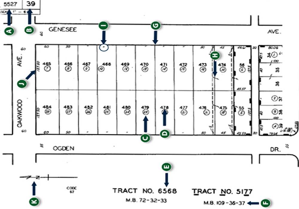
A. Assessor’s Book Number
First four numbers of the assessor’s parcel number (APN)
B. Assessor’s Page Number
Second three numbers of the assessor’s parcel number (APN)
C. Assessor’s Parcel Number
Third three numbers of the assessor’s parcel number (APN). Always shown in a circle on the plat map.
D. Lot Number
Shows the subdivision lot number of the property. This number is never circled.
E. Tract Number
Number given to a group of homes within a subdivision.
F. Abbreviated Tract Map Reference
Filing reference and is read: “Filed in Book 109, Pages 36 and 37 of maps, in the office of the County Recorder of said county.”
G. Lot Line
Solid line showing the boundaries of each lot on the map.
H. Tie Line
Indicates that two or more lots or portions of lots, are assessed as one assessor’s parcel.
I. Ditto Mark
Indicates lot dimensions are equal to the adjoining lot.
J. Approximate Lot Dimensions
Measured in feet, gives the approximate dimensions of the lot. subdivision.)
K. North Arrow
Always points in the true direction of North.
Explore Simi Valley Neighbourhoods
EXPLORE LOCAL NEIGHBOURHOODS IN Simi Valley